How to Buy Land Near Supply NC and Lockwood Folly
March 24, 2026
March 24, 2026
Imagine waking up to marsh views, breezes off the Lockwood Folly River, and a home designed just for you. If you’re eyeing land around Bolivia and Supply to build a coastal retreat, you’re smart to dig into the details before you buy. In this guide, you’ll learn how to check flood zones and elevation, confirm septic and utilities, understand waterfront and wetlands rules, and plan a build that fits your budget. You’ll also get a clear checklist and the right local contacts to move forward with confidence. Let’s dive in.
Much of Bolivia and Supply sits in unincorporated Brunswick County, which means the county handles zoning, floodplain management, septic and permits for most parcels. If you’re unsure whether a property is inside a town limit, confirm the boundary and zoning on the county’s interactive mapping tools. Start with the county’s GIS maps and parcel viewer to pull up parcel data, zoning layers, recorded plats, and potential flood information.
If the land is in a planned community like Lockwood Folly, also review recorded covenants and design guidelines. These can set standards for home size, docks, outbuildings, and landscaping. Your due diligence should include both county zoning and any neighborhood rules shown on the recorded plat or covenants.
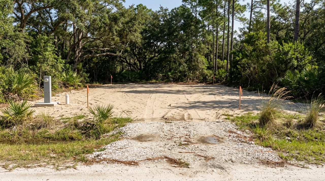
Coastal lots often sit in Special Flood Hazard Areas. Brunswick County directs buyers to its Flood Zone Viewer and FEMA flood maps for official designations. For permitting, the county enforces a local standard that raises the minimum building elevation above the mapped flood level.
Under the county’s Flood Damage Prevention Ordinance, where Base Flood Elevations are mapped, the Regulatory Flood Protection Elevation is BFE plus 2 feet. That extra margin affects finished-floor height, utility placement, and foundation type. Review the county’s Flood Damage Prevention Ordinance and confirm your panel and elevation with the county floodplain office using the county flood maps page.
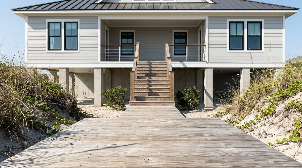
FEMA coastal maps include VE and AE zones, as well as a Limit of Moderate Wave Action. Even in parts of Coastal A or LiMWA, many builders and officials recommend open, pile-supported foundations with breakaway walls below the regulatory elevation. Discuss requirements and best practices with your engineer and the county before you finalize a design.
If a lot is in the mapped floodplain, most lenders will require flood insurance. Brunswick County participates in FEMA’s Community Rating System, which can reduce NFIP premiums for many properties. Get written insurance estimates early, and talk with your lender about how elevation, foundation type, and mitigation measures may affect loan terms.
For most residential lots outside sewered areas, septic feasibility is the make-or-break factor. The Brunswick County Environmental Health office administers onsite wastewater and well permits. Expect a soil and site evaluation, setback checks from waterbodies, and a county improvement permit before a building permit is issued. Start with the county’s Environmental Health septic and well page to understand the process and request existing permit records for the parcel.
Some properties that cannot obtain a standard septic permit may qualify for the county’s voluntary Rural Sewer Program. This program has specific eligibility rules and is not intended for new subdivisions. Review the Rural Sewer Program guidelines and application and confirm any service plans or line extensions with Brunswick County Public Utilities.
If county water or sewer is available, ask for tap-fee estimates and connection timelines as part of your offer due diligence. If a private well is needed, Environmental Health will also permit well construction.
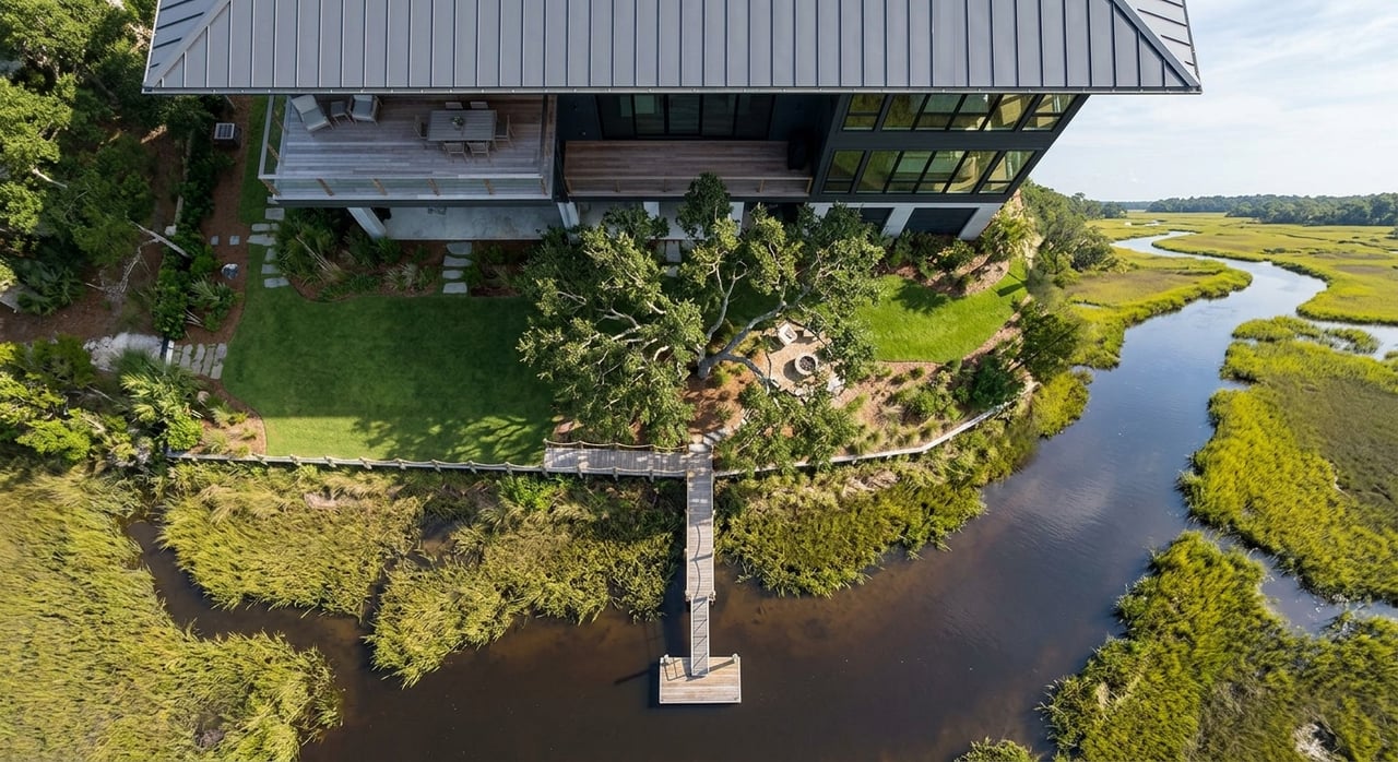
If your dream lot touches marsh, tidal creeks, or the Lockwood Folly River, plan for extra review. North Carolina’s CAMA program governs coastal development, and the state’s Division of Coastal Management reviews many shoreline projects. Use the state’s page for Brunswick County’s certified CAMA land use plan as a starting point, then discuss your specific scope with staff if you’re considering docks, bulkheads, or land disturbance near the water.
Work in navigable waters or wetlands can also trigger federal review. The U.S. Army Corps of Engineers, Wilmington District, handles Section 404 and Section 10 permits. If wetlands are a possibility, screen the site with the National Wetlands Inventory and plan for a professional delineation before you design. Learn more from the USACE Regulatory program and the National Wetlands Inventory overview.
If your lot fronts a state-maintained road such as US 17 or NC 211, you will need a driveway permit from NCDOT District 3. Review the state’s driveway permit user guide and factor the review timeline into your build schedule.
For electric service, coordinate early with Brunswick Electric Membership Corporation or the utility serving the area. New construction can require a temporary service pole, line extensions, or cost-sharing for new infrastructure. BEMC’s builder guide outlines typical steps, fees, and lead times.
Broadband can be variable in rural coastal pockets, so verify providers at the parcel address if high-speed internet is essential for you.
The land you choose around Bolivia, Supply, and Lockwood Folly directly shapes your home design, timeline, and costs. Here are the common scenarios you’ll see in Brunswick County’s coastal setting.
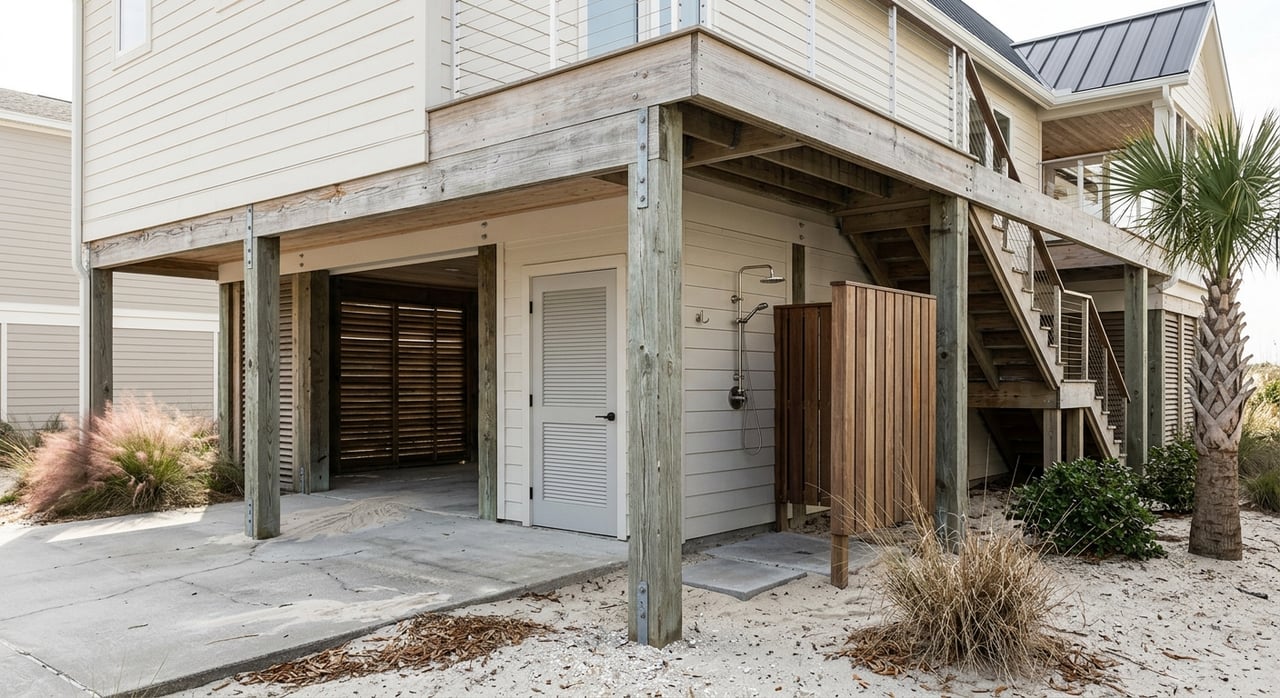
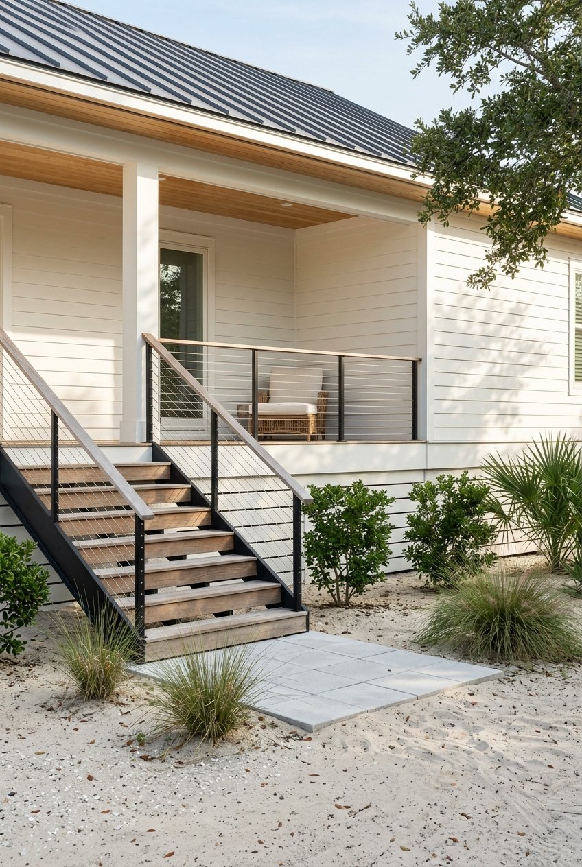
Expect elevated, open foundations, raised mechanicals and electrical, and limited non-habitable enclosures below the regulatory elevation. Exterior stairs and taller piers or piles add cost, and coastal permits can extend timelines. FEMA best practices favor open pile systems with breakaway walls where wave action is possible, which your engineer can tailor to your site.
Sandy or organic soils with high groundwater can require deeper foundations and sometimes engineered septic systems, like mounds or low-pressure dosing. A soils evaluation guides the septic layout and bedroom count, while a geotechnical boring helps size piles or footings. Build in time and budget for both.
Wetlands and coastal buffers can limit your footprint and shift where a house, driveway, and drain field can go. Docks may be possible but nearly always require state review and sometimes federal permits. If your lot was platted long ago, small-lot exceptions may exist, but they are technical and must be confirmed by Coastal Management.
Long drive runs and electric line extensions can add cost and coordination steps. If your access is via a private road, confirm recorded maintenance and utility easements. If your access is on a state road, add NCDOT’s driveway permit to your timeline early.
Flood-zone status affects loan requirements and ongoing premiums. The county’s CRS participation can reduce NFIP premiums, and private flood options may be available. Elevation, vents, and open foundations often help with rating, so keep your insurer looped in as you design.
Work this list before you go under contract or within your due-diligence window.
A thoughtful plan on the front end saves time, money, and surprises. If you want local guidance on specific parcels near Bolivia, Supply, and Lockwood Folly, our team is here to help you evaluate options and coordinate the right experts.
Ready to explore lots with a coastal-savvy plan? Connect with Hank Troscianiec and Associates to walk land, review maps, and build your due-diligence roadmap.
We pride ourselves in providing personalized solutions that bring our clients closer to their dream properties and enhance their long-term wealth. Contact us today to find out how we can be of assistance to you!